© 2014 Buckland Newton Parish Council Website last updated 7th September 2014 16:50
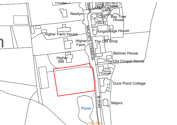
Site 1
Location
Field south of ‘Higher Still, west of B3143, opposite shop
© Crown copyright and database right (2014). Ordnance Survey Licence No. 100051694
Description
Area: 0.320 ha / 0.790 acres
9 homes suggested, perhaps a terrace of 5 fronting onto the road and 4 semi-detached or detached behind.
Development not to go too far to west as the ground slopes uphill in that direction. Access road to be in same
position as existing track. Also provide a small number of parking spaces at this point for the use of shop
customers. Pond at southern end to be preserved as green space